INTERACT is an infrastructure project under the auspices of SCANNET, an arctic network of 70 terrestrial field bases (formerly 89, but collaboration with Russia is currently on hold) in northern Europe, US, Canada, Greenland, Iceland, the Faroe Islands and Scotland as well as stations in northern alpine areas. INTERACT specifically seeks to build capacity for research and monitoring all over the Arctic, and is offering access to numerous research stations through the Transnational Access Program.
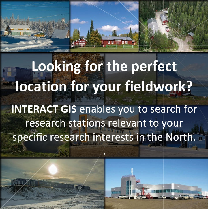 INTERACT GIS enables you to search for research stations relevant to your specific research interests in arctic, boreal and alpine regions.
INTERACT is a network of research stations located in the Arctic and northern boreal and alpine regions.
The INTERACT GIS system has been developed by the research stations to provide a one-stop-shop for information about their facilities, activities and surroundings.
INTERACT GIS contains information about 70+ research stations.
You can find all you need to know about the research station you want to visit, including description of the station, facilities, contact information, and links to websites and access to application systems.
INTERACT GIS allows you to search for stations relevant to your specific research interests and needs.
Filtering functions highlight the stations that meet the criteria you select, e.g. location, landscape features, climate, natural environment, science, etc.